Hi, there,
My team is using Grove barometer (High-Accuracy) with Jetson Nano to catch the altitude of target devices.
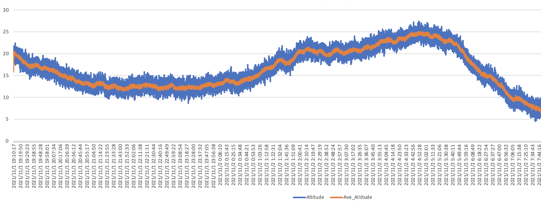
Last night we put one on the device and the device was static all night, then we get a altitude curve like this:
the blue line is the value we received from the module and the orange line is ave-30 smoothing value.
We use the sample code pulling from Grove’s Github to read the value from the module, and it seems quite OK.
Can anyone explains the reason why the altitude has such variation? This is harmful for our applications.
Thanks a lot!
